Please note that all charts are nominally folded in half for storage and handling as per the marine industries standard.
If you require an unfolded copy (ie: flat for framing), please select Flat Paper, and we will organise a special print service to accomodate your request.
Description
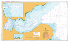
This official Nautical Chart is produced by the Australian Hydrographic Office, and corrected fortnightly to 'Notice to Marines' by Cairns Charts & Maps. This ensures it remains compliance with Safety of Navigation requirements. This marine chart, or 'sea map', is primarily produced to support the safe navigation of commercial shipping through Australian, Papua New Guinea and Solomon Island waters.
Nautical charts depict the seabed, or bathymetry, using a variety of colours to shade the depth regions. Darker blues indicate shallower water, while light blues and white indicate deeper water. A chart will also show continuous contour lines (at varying intervals depending on the scale of the chart), 'spot depths' across the whole area, as well as different symbols indicating wrecks, shallow rocks and dangers, as well as details on lights, light houses, tides and currents.
For extensive detail on the symbology of nautical charts, the Symbols and Abbreviations used on Admiralty Charts is the definitive reference.
Kia Ora Spray Farm Koonanguri Carinya Hermsley Cheriton The Springs Lowfields Trawalla Inverness Clifton Springs Drysdale Geelong Indented Head Lara Leopold Portarlington St Leonards Adrian Mannix Reserve Alcoa Works Grammar School Jetty Arthur The Great Light Arthur The Great Spit Geelong West Primary School Avalon Aerodrome Avalon Aircraft Control Tower Barwon Bridge Bates Point Beacon Point Beckley Park Bellarine Bellarine Bank Bellarine Beacon Bellarine Highway Bellarine Primary School Bellerine Primary School Belmont Common Belmont Park Bird Rock Boer War Memorial Park Brearley Reserve Cheetham Salt Works Chirnside Reserve City Channel Coles Channel Commonwealth Explosives Pier Corio Geelong Inner Harbour Corio Secondary College Corio Channel Corio Freezing Works Corio Post Office Corio Primary School Corio Quay Corio Quay North Wharf Corio Quay South Wharf Corio South Primary School Corio West Primary School Railway Pier Curlewis Doug Simpson Reserve Drysdale Police Station Drysdale Post Office Drysdale Primary School Eastern Beach Eastern Cemetery Eastern Park Stony Jetty Edwards Point Reserve Elcho Park Golf Course Evans Reserve Fisherman Gully Fletchers Pier Flinders Peak Secondary College Ford Motor Works Geelong Cricket Ground Geelong East Primary School Geelong Grammar School Geelong High School Geelong Hospital Geelong Magistrates Court Geelong Market Square Geelong North Geelong North Primary School Geelong Police Station Geelong Racecourse Geelong Rifle Range Geelong South Primary School Geelong West Oval Geelong-Melbourne Railway Goat Island Governor Reef Grassy Point Grovedale Primary School Half Moon Bay Hamilton Highway Hardings Reach Hendy Street Reserve Lewis Bight Hopetoun Channel Howard Glover Reserve Inner Governor Reef James Harrison Bridge Jerringot Wildlife Sanctuary Kardinia Park Keith Barclay Oval Kirks Point Lake Borrie Lake Lorne Lara Fire Station Lara Hall Lara Lake Primary School Lara Police Station Lara Primary School Lascelles Wharf No. 1 Lascelles Wharf No. 2 Leopold Cemetery Leopold Fire Station Leopold Memorial Park Leopold Primary School Leopold Public Hall Lillias Point Limeburners Creek Limeburners Point Long Reef Matthews Flinders Girls High School Metropolitan Farm Midland Highway Moolap Moolap Primary School Moorpanyal Park Moranghurk Mount Bellarine Murradoc Hill Murtcaim Newcomb Primary School Newcomb Secondary College Newcomb South Primary School Norlane Police Station Norlane Primary School North Channel North Geelong North Shore North Shore Primary School Osborne Park Outer Harbour Paywit Phosphate Works Pirra Childrens Home Point Abeona Point George Point Henry Point Henry Pier Point Richards Point Richards Bank Point Richards Channel Point Wilson Point Wilson Bank Portarlington Police Station Portarlington Primary School Prince George Bank Prince George Light Refinery Pier Rippleside Beach Rippleside Pier Rosewall Primary School Royal Geelong Yacht Club Seabreeze Caravan Park Seamens Mission Serendip Wildlife Research Station Silver Sands Caravan Park Sladen Park Snake Island South Barwon Reserve South Channel South Geelong The Bluff St Albans Park St Helens Beach St Leonards Primary School St Leonards Telephone Exchange Stead Park Steeles Stern Loading Terminal Stingaree Bay Sutcliffe Reserve Tate Street Primary School Geelong Ted Wilson Trail The Sand Hummocks Wedge Point Wedge Spit West Channel Pile Light Western Beach White Woman Reef White Woman Rock Whittington Primary School Wiffen Willey Langdon Reserve Wilson Spit Wilson Spit Channel Windsor Reserve Woornyalook Yarra Pier Werribee Sewage Farm Little River Lara Lake Kirk Point Limeburners Bay Arthur the Great Spit Hovells Creek Point Lillias Lascelles Wharf Norlane North Wharf South Wharf Bulk Wheat Pier North Geelong Station Corio Bay Steeles Rock Geelong West Spray Cote Royd Cunningham Pier Geelong Harbour Hood Bight Hoods Bight Eastern Pier Point Batman Geelong Municipality Middle Creek North Red Bluff Belmont Curlewis Bank Beenleigh Green Vale Saint Leonards Leopold Station Murradoc South Red Bluff Grovedale Marshalltown Marshall Wallington The Basin Parklands

