
QLD 9447
QLD 9447
Digital Products: You will receive an email shortly after checkout containing links to download your products.
If you do not receive this email within 30min, please check your Junk / SPAM email folder, prior to contacting us.
Description
This Topographic Map is produced by the Department of Natural Resources and Mines (DNRM), part of the Queensland Government.
This product is continously updated with the latest information available. New editions are generally published in Oct/Nov each year, however minor updates are constantly being included.
DNRM maps are produced automatically by computers, with minimal human oversight; so some duplication of information and occasional minor cartographic inconsistencies can be found.
The PDF version of this can be printed at home or sent to a professional printer for a 100% scale reproduction.
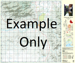
At this scale, 1cm on this map represents 1km on the ground. A standard map (which is square) covers an area of approximately 54km by 54km, with a contour interval of 20m. This map contains natural and constructed features including road and rail infrastructure, vegetation, hydrography, contours, localities and some administrative boundaries.
Toogoom Stony Creek Tandora Booral Burrum Heads Craignish Dundowran Dundowran Beach Hervey Bay Howard River Heads Torbanlea Woodgate Beach Alderney Island Aldershot Alligator Creek Beaver Rock Beelbi Creek Bennetts Waterhole Big Woody Island Bingham Black Rock Black Swamp Creek Brothers Islands Bunya Creek Burgowan Burrum Burrum Point Burrum River Burrum Coast National Park Burrumba Buttenshaw Bank Cherwell River Colton Crab Islands Crab Point Datum Point Datum Rock Dayman Dayman Point Dayman Spit Devils Elbow Doolong Flat Doongul Creek Duck Creek Duckinwilla Creek Dundathu Reach Eli Point Ferguson Fison Point Fork Bank Gables Point Gatakers Bay German Creek Gregory Islands Gregory River Guernsey Island Gunchellan Swamp Harwood Creek Heath Island Hercules Horseshoe Bank House Creek Inner South Head Isis River Jacobsons Hill Jeffery Rock Jersey Island Johnny Point Johnnys Creek Kangaroo Island Lagoon Creek Leg Bank Little Rocky Creek Logbridge Creek Lorne Bank Mangrove Island Mangrove Islands Mangrove Point Maria Creek Marsh Creek Mary River Maryborough Meereenyoor Creek Meteor Point Middle Bank Middle Bluff Mooan Moolyyir Creek Moon Point Nikenbah North Bluff North Head North Shore Point O'Regan Creek Outer Banks Oyster Bank Oyster Rocks Panama Creek Pearl Bank Phoenix Waterholes Picnic Island Pilbil Waterhole Point Vernon Powell Creek Power Island Pulgul Creek Reindeer Rock Richmond Creek Rocky Creek Rocky Point Round Island Saltwater Creek Sandfly Creek Sandy Point Sandy Point Bank Sark Island Sawpit Creek Scott Rock Separation Point Shell Bank Shelly Bank Sheridan Island Ship Channel Shoulder Point Sinfields Hill South Bank South Head South Point South White Cliffs O'Regan Creek Conservation Park St Helens Maryborough City Stockyard Creek Sugarbag Creek Susan Island Susan Point Susan River Takura Heights Tea-Tree Creek The Pines Theodolite Creek Tooan Tooan Creek Toogoom Waterhole Turkey Creek Upper Mouth Susan River Urangan Vernon Walker Reach Walkers Point Walliebum Walliebum Lagoon Walliebum Waterhole Walsh Walsh Island Wanggoolba Creek Watson Creek Woolmer Creek Lake Lenthall Wokka Beelbi Creek Conservation Park Duggan Conservation Park Vernon Conservation Park Gobbles Gully Aldershot Maryborough City Island Plantation Aldershot Hervey Bay City Burrum Town Duckinwilla Dundathu Eli Waters Great Sandy Strait Hervey Bay City Kawungan Pacific Haven Pialba Prawle Scarness Sunshine Acres Takura Torquay Urraween Walligan Wondunna Eli Creek Wide Bay Wongi Forest Reserve Woodgate Traviston Buxton Cherwell Creek Strathdee Creek Strathdees Creek Vernon Point ORegan Creek ORegan Creek Conservation Park Round Islet Woody Island Long Middle Bank Scrub Hill Ghost Hill Duck Islands Shell Island Ketch Spit Great Sandy Strait