Please note that all charts are nominally folded in half for storage and handling as per the marine industries standard.
If you require an unfolded copy (ie: flat for framing), please select Flat Paper, and we will organise a special print service to accomodate your request.
Description
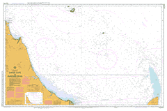
This official Nautical Chart is produced by the Australian Hydrographic Office, and corrected fortnightly to 'Notice to Marines' by Cairns Charts & Maps. This ensures it remains compliance with Safety of Navigation requirements. This marine chart, or 'sea map', is primarily produced to support the safe navigation of commercial shipping through Australian, Papua New Guinea and Solomon Island waters.
Nautical charts depict the seabed, or bathymetry, using a variety of colours to shade the depth regions. Darker blues indicate shallower water, while light blues and white indicate deeper water.A chart will also show continuous contour lines (at varying intervals depending on the scale of the chart), 'spot depths' across the whole area, as well as different symbols indicating wrecks, shallow rocks and dangers, as well as details on lights, light houses, tides and currents.
For extensive detail on the symbology of nautical charts, the Symbols and Abbreviations used on Admiralty Charts is the definitive reference.
Captain Creek Taronne Taunton Euleilah Rosevale Woodbank Red Hill Wytaliba Maranoa Hillview Wandoona Myrtlevale Tottenham Teebar Rose Farm Bentleys Lodge Pittucks Farm Glenview Velenet Lilyvale Bauer Briarwood Essendean Kanool Hill Rosedale Glenmore Worylah Hawthorne Highfields Mountain View Roseville Dumbarton Ferngrove Miara Moolyung Agnes Water Burnett Heads Moore Park Seventeen Seventy Annies Waterhole Arthur Creek Avondale Baffle Baffle Creek Barubbra Island Berajondo Black Snake Creek Blackwater Creek Blue Gum Waterholes Boiling Crossing Booyan Bottle Creek Branch Creek Brandy Creek Breaksea Spit Broadwater Creek Bucket Gully Bull Holes Bullock Creek Bundaberg Harbour Burnett River Bustard Bay Bustard Head Camp Creek Camp Island Cattle Creek Clark Point Clews Point Cockadoodle Creek Cockatoo Creek Coureys Creek Cow Creek Croome Creek Deepwater Creek Double Sloping Hummock Drew Shoal Duck Creek Emu Creek Euleilah Creek Eurimbula Beach Eurimbula Creek Fairymead Creek Figtree Creek Five Mile Creek Flagstone Creek Flinders Four Mile Creek Four Mile Hut Creek Fourth Camp Creek Fullers Creek Gil Blas Point Goat Creek Grants Island Grevillea Creek Gwynne Range Hacking Hill Halfway Creek Herald Patches Home Creek House Creek Inner Rocks Island Creek Jacob Creek Jam Pot Creek Jenny Lind Creek Knight Crossing Kolan River Lady Elliot Island Lady Musgrave Island Lagoon Creek Landsborough Creek Landsborough North Creek Landsborough South Creek Littabella Littabella Creek Little Mosquito Creek Little Pig Island Long Island Long Shoal Lowmead Mackay Island Manning Creek Mount Maria Matchbox Range Maude Hill Middle Creek Middle Island Middle Rocks Mitchell Creek Monument Point Moorland Morgan Island Mosquito Creek Mullett Creek Munro Range Murphy Creek Murrays Creek Native Dog Creek New Bundaberg Oaky Creek One Mile Creek One Tree Hill Ort Creek Outer Rock Oyster Creek Palm Tree Swamp Pearson Creek Pig Creek Pig Island Pipe Clay Creek Porpoise Shoal Prospector Creek Quondong Red Rock Reedy Creek Rocky Creek Rocky Point Rooke Creek Rothman Creek Round Hill Round Hill Creek Round Hill Head Royal Gully Rules Beach Saltwater Creek Sandy Cape Sandy Creek Scrubby Creek Separation Point Sheep Station Creek Sleepy Creek Snake Creek South Gwynne South Head Spring Creek Mouth of Baffle Creek Conservation Park Two Mouth of Kolan River Conservation Park Takoko Tanti Tanti Creek Taronne Creek Taunton Creek Third Camp Creek Toowong Hill Tusky Creek Two Mile Creek Two Mile Knob Uxbridge Walkers Crossing Walsh Creek Ward Creek Wartburg Washpool Lagoon Watalgan Range Welcome Creek Mount Whacogo Wreck Rock Yandaran Yandaran Creek Baffle Creek Conservation Park Barubbra Island Conservation Park Bottle Creek Conservation Park Broadwater Conservation Park Deepwater National Park Deepwater Resources Reserve Eurimbula National Park Eurimbula Resources Reserve Joseph Banks Round Hill Head Conservation Park Littabella National Park Mouth of Baffle Creek Conservation Park One Deepwater Eurimbula Rosedale Miriam Vale Shire Boaga Fairydale North Gooburrum North Littabella Skyringville Bustard Head Conservation Park Sandy Cape Conservation Park Wallace Creek Fairymead Moore Park Beach Rosedale Bundaberg Regional Council Watalgan Waterloo Winfield Lady Musgrave Islet Outer Rocks Inner Rock Lady Elliot Islet Lady Elliott Island Round Hill Head Conservation Park Curtis Channel Red Rocks Wreck Rocks Fuliers Creek Fuller Creek Port of Baffle Creek Murray Creek Mullet Creek Grevillia Creek Litabella Creek Moon Point Sandy Point Woakoh North Coast North Head Clarke Point Port Bundaberg

