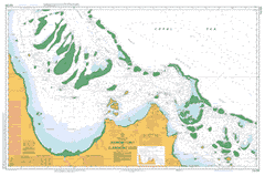
Please note that all charts are nominally folded in half for storage and handling as per the marine industries standard.
If you require an unfolded copy (ie: flat for framing), please select Flat Paper, and we will organise a special print service to accomodate your request.
Description
This official Nautical Chart is produced by the Australian Hydrographic Office, and corrected fortnightly to 'Notice to Marines' by Cairns Charts & Maps. This ensures it remains compliance with Safety of Navigation requirements. This marine chart, or 'sea map', is primarily produced to support the safe navigation of commercial shipping through Australian, Papua New Guinea and Solomon Island waters.
Nautical charts depict the seabed, or bathymetry, using a variety of colours to shade the depth regions. Darker blues indicate shallower water, while light blues and white indicate deeper water. A chart will also show continuous contour lines (at varying intervals depending on the scale of the chart), 'spot depths' across the whole area, as well as different symbols indicating wrecks, shallow rocks and dangers, as well as details on lights, light houses, tides and currents.
For extensive detail on the symbology of nautical charts, the Symbols and Abbreviations used on Admiralty Charts is the definitive reference.
Old Silver Plains Abbey Peak Alligator Creek Altanmoui Range Annie River Atkinson Reef Aylen Patch Balclutha Balclutha Creek Baron Reef South Barrow Island Barrow Point Bathurst Bay Bathurst Head Bathurst Range Bay Hill Beabey Hill Beabey Patches Beanley Island Bewick Island Bizant River Blackwood Island Boulder Rock Cape Bowen Breakfast Creek Broomfield Rock Burkitt Island Calmurra Cameron Shoal Cape Rock Castle Peaks Channel Rocks Clack Island Clack Reef Claremont Isles Claremont Point Clark Shoal Cliff Islands Combe Island Combe Point Combe Reef Cone Peak Conspicuous Peak Coquet Island Coral Patch Corbett Reef Creech Reef Crescent Reef Davie Reef Davy Patches Dayman Rock Denham Island Dinner Creek Eden Reef Eumangin Creek Evanson Point Eves Reef Fahey Reef Fife Island Fifteen Mile Creek Five Mile Creek Flat Hill Flinders Group Flinders Island Flinders Peak Flinders Rock Cape Flinders Fly Channel Goose Swamp Gorge Creek Grub Reef Hales Island Hannah Island Harmal Hay Island Hedge Reef Helby Rock Heming Point Holdsworth Rock Houghton Island Howard Bluff Howick Group Howick Island Ingram Island Iris Reef Jane Table Hill Jeannette Hill Joan Reef June Reef Keast Shoal Kestrel Reef King Island Kinnaird Leggatt Island Leichhardt Creek Lily Vale Lytton Reef Maclear Maclear Island Magpie Reef Marrett River Massy Creek Megaera Reef Melanie Rock Melville Melville Passage Melville Range Cape Melville Mid Reef Miles Hill Miles Reef Moojeeba Munro Reef Nares Hill Nares Point Newton Island Nineteen Mile Creek Ninian Ninian Bay Noble Island Noddy Reef Normanby River North Bay Point North Channel North Kennedy River North Warden Reef Obree Reef Olive Patch Olver Rock Oswald Shoal Owen Channel Pelican Island Pipon Islands Pipon Shoals Pirie Head Poulsen Rock Princess Charlotte Bay Pullen Point Rattlesnake Channel Rattlesnake Reefs Rocky Islets Rocky Point Island Rodda Reef Saltwater Creek Sand Islet Scrubby Creek Sentry Rock Simpson Rock Singleton Patch Snake Reef South Warden Reef St Pauls Hill Stainer Islet Stainer Rock Stanley Island Stapleton Island Stewart River Port Stewart Stokes Bay Stony Hill Sullivan Shoal Switzer Reef Taiwan Shoal Tamulan Creek Temple Creek Temple Hill Three Mile Lagoon Twin Peaks Tydeman Reef Unison Reef Wakooka Wakooka Creek Walch Hill Waterwitch Passage Watson Island Wedge Rocks Weigall Reefs Wharton Reef Wilkie Island Wilson Reef Wilson Rock Wooden Patch Yule Rock Lowry Passage Claremont Isles National Park Cliff Island National Park Flinders Group National Park Howick Group National Park North Barrow Island Cape Melville National Park Lama Lama National Park End Reef Emma Reef Elf Reef Claremont Islands Ballerina Shoal Roberts Point Kei Reef Fairway Channel The Gut Massey Creek North Broken Passage Stainer Island Aye Reef West Melville Pass West Melville Passage South Broken Passage Melville Pass Sea Reef Jee Reef Eff Reef Clack Islet Be Reef Ead Reef Pipon Island Pipon Islets Dhu Reef Aid Reef North Doubleyew Reef Alderley Point Owan Channel Richards Point Balclutha River Hales Islet Waterwitch Channel Watch Hill Saint Pauls Hill Rocky Point Islet South Doubleyew Reef Yew Reef Running Creek Monro Reef Tea Reef Stapleton Islet Barrow Islands Barrow Islets Sand Hills Abbey Peak Mission Combe Islet Coombe Island Bathurst Head Outstation Ingram Islet Coombe Reef Beanley Islet North Learmonth Nineteen Mile Yard Clayhole Yards Warson Island Leichardt Creek Lilly Vale Kennedy River Jeanette Hill Howick Group Island Wurkuldi Aloszville Sand Island Marina Plains Wakooka Outstation Kennedy Loading Yard Red Point Megaera Rock

