Please note that all charts are nominally folded in half for storage and handling as per the marine industries standard.
If you require an unfolded copy (ie: flat for framing), please select Flat Paper, and we will organise a special print service to accomodate your request.
Description
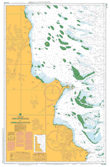
This official Nautical Chart is produced by the Australian Hydrographic Office, and corrected fortnightly to 'Notice to Marines' by Cairns Charts & Maps. This ensures it remains compliance with Safety of Navigation requirements. This marine chart, or 'sea map', is primarily produced to support the safe navigation of commercial shipping through Australian, Papua New Guinea and Solomon Island waters.
Nautical charts depict the seabed, or bathymetry, using a variety of colours to shade the depth regions. Darker blues indicate shallower water, while light blues and white indicate deeper water.A chart will also show continuous contour lines (at varying intervals depending on the scale of the chart), 'spot depths' across the whole area, as well as different symbols indicating wrecks, shallow rocks and dangers, as well as details on lights, light houses, tides and currents.
For extensive detail on the symbology of nautical charts, the Symbols and Abbreviations used on Admiralty Charts is the definitive reference.
Bramwell Ada Reef Albatross Cove Alligator Creek Andrew Reef Aplin Islet Aylen Hills Baird Island Baloy Hills Bannan Reef Barrett Hill Batavia Downs Bazley Beesley Island Berney Beth Creek Bethell Beverley Creek Bird Isles Black Hill Blue Bell Rocks Bolt Head Boothby Bootie Island Boreel Bosanquet Hill Bowyer Boydong Cays Boydong Island Boynton Bremner Shoal Briar Hill Brisco Bromley Bromley Creek Brunner Buchan Rock Burke Reef Bushy Island Cairncross Islets Camisade Creek Captain Billy Creek Carbutt Carden Carnac Caroline Rock Carron Hill Cassowary Creek Chilli Or Gunyah Creek Chimmo Shoal Cholmondeley Islet Clerke Island Cockburn Islands Cockburn Patch Cockburn Reef Collette Reef Conical Hill Corry Cridland Hill Croft Curd Reef Daniell Reef Denham Passage Dinner Creek Mount Dobson Dolphin Reef Dorriwill Ridge Double Point Double Rock Douglas Islet Dulhunty East Islets Edward Shoal Eel Reef Erlangen Patch Ethel Islet Fair Cape Fairway Reef False Orford Ness Farmer Island First Stony Point Fisher Island Fison Reefs Forbes Islands Forwood Reef Gallon Reef Garraway Creek Glennie Creek Glennie Inlet Goddard Hills Gordon Creek Gore Island Grenville Cape Grenville Cape Griffith Gunyah Or Chilli Creek Guthray Reef Haggerston Island Halfway Islet Hamilton Creek Hann Creek Hannibal Islands Harmer Creek Harvey Island Hazel Reef Helby Hill Hicks Island Highgate Hill Home Islands Horse Creek Horseshoe Creek Hunter Hill Hunter Inlet Hunter Point Hunter Reefs Hurdle Creek Huxley Hill Indian Bay Inman Rock Inset Reef Jacky Jacky Range Janet Ranges Jardine Islet Jardine River National Park Joyce Hill Junie Creek Kangaroo River Kangaroo Shoals Kay Islet Kay Reef Kemp Rocks Kennedy Hill Lambert Hill Larrards Hill Laurel Reef Left Hill Lion Reef Little Boydong Islet Loftus Logan Jack Creek Long Pocket Lovaine Macarthur Islands Mackenzie Creek Macmillan River Magra Islet Manley Island Margaret Bay Mason Reef Messum Hill Middle Peak Middle Banks Middle Reef Milman Milman Islet Moody Reef Mosquito Point Nelson Range Mount Nelson Nigger Head Nob Island Nomad Reef North Channel North Pap Ogilvie Hill Old Man Rock Olive River Onslow Reef Orford Bay Orford Ness Orton Island Outer Reef Packers Creek Paddys Creek Paluma Passage Paluma Shoal Parsons Reef Pascoe Pascoe River Passage Reef Pearn Reef Perry Island Pickard Reef Pickersgill Islet Pig Hole Hill Pig Island Pigeon Island Piper Islands Piper Reef Pirie Islet Pollard Channel Portland Road Puddingpan Hill Queue Reef Quoin Island Red Cliffs Red Hill Restoration Island Restoration Rock Richardson Range Robyn Hill Rocky Island Rodney Island Round Back Hills Round Point Saddle Hill Sandy Creek Sandy Islet Saunders Islet Scorpion Creek Scrub Hen Creek Scrubby Creek Second Stony Point Shelburne Shelburne Bay Simpson Hill Sir Charles Hardy Islands South Reef Spider Creek Stanley Hill Sunday Islet Symonds Passage Tannadice Rock Tannadice Shoal Tattam Hill Temple Bay Thorpe Point Thrush Reef Tin Creek Turning Point Patches Twin Reefs Tynemouth Rock Tyrrel Reefs Ussher Point Viking Reef Wall Hill Wallace Islet Waterhole Bay Weymouth Weymouth Bay Cape Weymouth White Point Wilds Shoal Wilson Creek Wizard Reef Wreck Reef Young Reef Hudson Bay Denham Group National Park Forbes Islands National Park Iron Range National Park Iron Range Resources Reserve Piper Islands National Park Quoin Island National Park Restoration Island National Park Saunders Islands National Park Sir Charles Hardy Group National Park Parkinson Reef Monkman Reef Cochin Reef Kupuntutu Passage Jardine River Cook Shire Wenlock Milman Island Aplin Island Douglas Island Cairncross Cairncross Islands Bushy Islet Orfordness Onslow Patch Denham Pass Shady Lagoon Cholmondeley Island Halfway Island False Orfordness Jardine Island Pearn Rock Wallace Island Little Boydong Island W Reef Hannibal Island V Reef Captain Billy Landing Saunders Island Tee Reef Bird Islands Inman Pig Islet Bootie Islet Manley Islet Cockburn Islets Magra Island Rodney Islet Larangalia Creek Paluma Sunday Island Larangalia Wolona Oueue Reef Que Reef Water Hole Bay Cape Greenville Ethel Island River Macmillan Haggerstone Island Off Reef Emm Reef Ell Reef Enn Reef Kay Island Beesley Islet Baird Islet Farmer Islet Fisher Islet Aich Reef Forbes Islets Jih Reef Mosquito River Eft Reefs Fison Reef Quoin Moreton Cassowa Creek Nelson Creek Wattle Hill Symonde Pass Por Island Rocky Islet Edwards Shoals Edwards Shoal Chili Creek Gunyah Creek Albatros Cove Hamilton Hill Shea Hill Iron Range Iron Range Mine Ape Reef Garraway Hill

